The Uluguru Mountains are found on the eastern side of Tanzania and are named after the Luguru tribe of Morogoro. The central portion of the Uluguru mountains is a ridge running roughly north-south and rising to 2,630 metres (8,600 ft) altitude at its highest point. On the main Uluguru range, 50 villages touch the forest boundary. Over 151,000 people are found within the mountain area, often at increasing densities at higher altitudes up to the forest boundary.
The Ulugurus lie 200 km inland from the Indian Ocean. They are part of a chain of mountains in eastern Africa collectively called the Eastern Arc Mountains, which include the Taita Hills, Pare Mountains, Usambara Mountains, Nguru Mountains, Rubeho, Ukaguru, Udzungwa Mountains and Mahenge Mountains. The forests of the mountains provide the water catchment areas for the streams and rivers. This water flows mainly from the forest-capped peaks of the Ulugurus into streams, joining to form the Ruvu River.
Biodiversity
The vegetation of the Uluguru main ridge and outlying blocks is highly variable. It ranges from drier lowland coastal forest habitats to transitional rainforests to sub-montane, montane and upper-montane forest types.
Unique to the Ulugurus are over 100 plants, two birds, two mammals, four reptiles and six amphibians unknown elsewhere. Many additional species are shared only with one or two other Eastern Arc mountains; hence, they are globally rare. Endemic species include African violets, Impatiens and Begonias, which are popular pot plants in the rest of the world.
Tourism
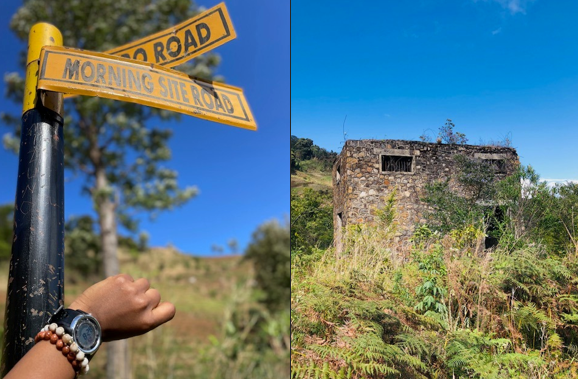
The mountains attract many tourists to the area, mainly due to the mountain’s proximity to the former capital and economic centre of Tanzania, the city of Dar es Salaam (180km away). A visit to the “Morning side”, which is an old German hut at 1000 m, is one of the famous shot day hikes, a visit to Choma waterfalls, Bondwa and Lupanga peaks, a cultural tour to the “Waluguru” tribe, farmlands and many more.
READ RELATED: The World’s Oldest Ship, Once Sunken and Revived, Currently Sails in Tanzania’s Coastal Waves.
Bondwa Peak is located close to Morogoro town through the morning side (6.3km from the town centre), where you can walk through Uluguru forest to the peak for about 8-9 hours and return walk. Bondwa Peak has a spectacular view of Morogoro town and other areas and is one of the highest peaks of the Uluguru mountains, coming second after Lupanga Peak.
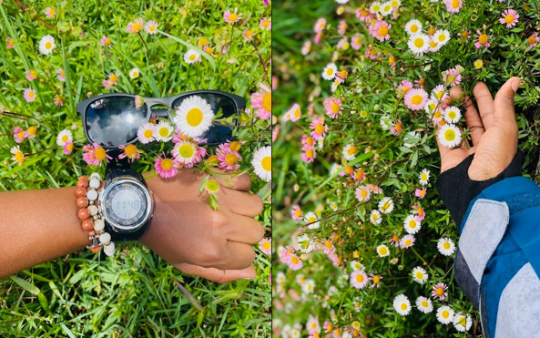
Bondwa Peak is about 2080 meters above sea level. On the way to the peak, you can see Uluguru flowers, birds, and monkeys such as Black and white Colobus monkeys and blue monkeys, and sometimes you may see endemic species of chameleons that are found in Uluguru mountains nowhere else in the world, such as Werner’s chameleon (Trioceros Werner) or Three horned chameleons.
Our hike begins from a small village called Ruvuma, but alternatively, one can start the walk from the Morning Site. To get to Ruvuma, you must take a motorcycle, “bodaboda”, from the regional commissioner’s office (famously known as ‘kwa Mkuu wa mkoa’), which takes around 30 to 45 minutes.
We left Solomon Mahlangu campus, where we were staying, at 6 am as we had intended to begin our hike before the sun was bright. We arrived at Ruvuma at 7, and our kind guide offered us breakfast with his family. We set out for Bondwa at 7:21 am.
The pace depends on your fitness level, but it is best to begin hiking early before the sun is intense. One hour later, we reached the Morning site and continued past the farms to a place with a house named ‘powerhouse’, and Hamisi (our tour guide) told us that it was the source of electricity in the old days. This also marked the start of the dense forest.
We arrived at Bondwa Peak at 11:48 am. The weather was chilly; fog covered some of the surrounding peaks, and the path to the top was lined with beautiful flowers.
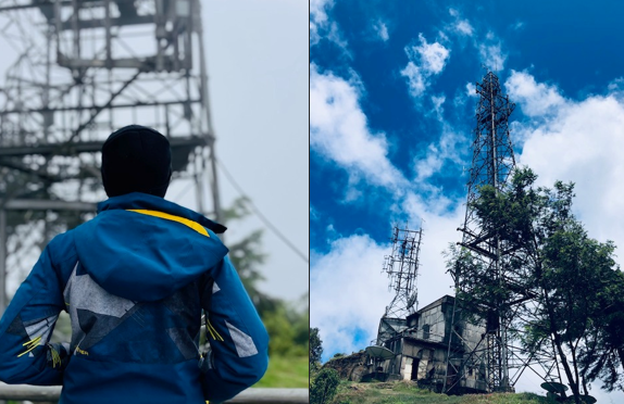
The view from the top was worth the toil we had gone through. On the peak is a radio tower built in the 1950s that serves most radio stations in Morogoro.
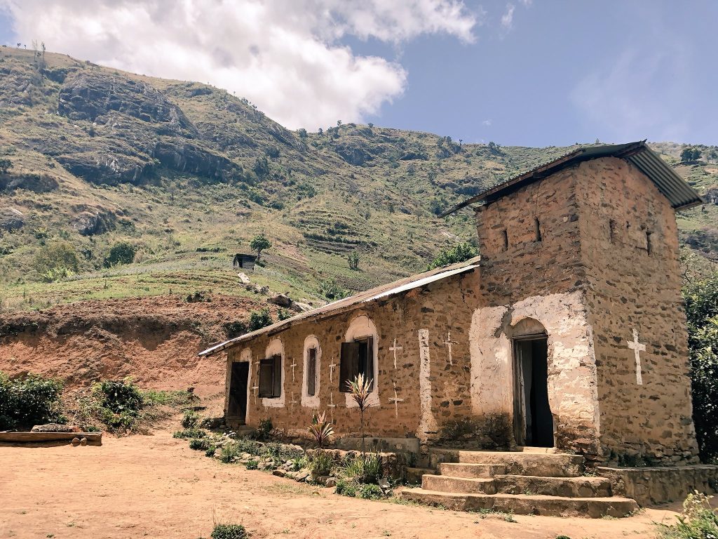
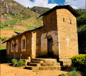
Soon, we had to descend because it was about to rain, and we opted to take a shorter route as we descended, which turned out to be very steep and slippery. Occasionally, one of us would slip, but we would laugh it off and continue because, as the saying goes, “At the end of the day, your feet should be dirty, your hair messy, and your eyes sparkling”. As we got lower and lower, we soon found ourselves amid the strawberry farms, and soon we reached the old German church, which was built in 1914 of stone. It still stands strong today and is used by some of the locals.
We returned home, bringing many plants as souvenirs- strawberries, strawberry plants, mint, rosemary and lemon grass.
What to pack:
- Water
- Soft drinks
- Snacks
What to wear
Generally, it is recommended that you put on comfortable clothes.
- Wear non-slip hiking shoes; the trail is often slippery due to fallen leaves and morning dew.
- Long pants/tights since you will be passing through areas of long grass
- A jacket because it can get cold at the top
Happy exploring!